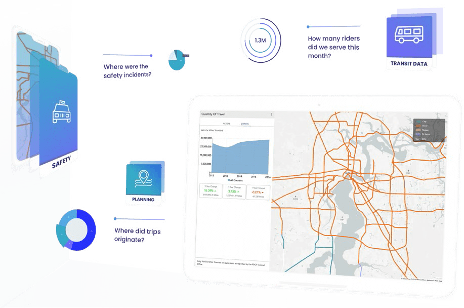
Urban SDK streamlines government and IoT data to automate performance measures and discover insights in real-time, helping to transform cities’ mobility, transportation, and safety operations.
Established in 2018 by Justin Dennis and Drew Messer, Urban SDK is a digital government intelligence platform combining real-time location data with predictive analytics. It provides software-as-a-service (SaaS) to combine real-time location data, predictive analytics, and a data marketplace to automate performance indicator dashboards to track performance, predict needs, and visualize big data at the street level to increase productivity and decision-making. Transportation, transit, law enforcement, and government organizations gain intelligence and data management to predict mobility and safety patterns such as traffic, parking, pedestrian movement, and safety incidents.
“We believe the future city is connected digitally and physically… Our mission is to connect community assets, services, and systems with digital intelligence to impact quality of life.”
– Justin Dennis
Just a Quick Note:
InnovationsOfTheWorld.com has partnered with Trade License Zone (TLZ) to support global innovators looking to expand internationally. Take advantage of the UAE’s Free Zones—enjoy streamlined setup, low corporate taxes, and a strategic gateway to the Middle East and beyond.
Get Your UAE Free Zone License Fast & Easy!Urban SDK additionally provides a data exchange to connect transportation systems with a collaborative data platform of 140+ real-time datasets for end-to-end integration and advanced analytics.
“Public officials and transportation engineers struggle with manual research, data requests, and inconsistent data to measure and plan their mobility system,” Partner Justin Dennis said in a statement. “Urban SDK provides data management and predictive intelligence software for transportation engineers and transit engineers much like navigation apps for drivers of connected vehicles.”
By collecting disparate data, connecting devices, and systems, and then analyzing and interpreting that data, Urban SDK can automate responses and also predict outcomes, making an asset of IoT data. Streamlining data streams in this way gives cities the tools they need to improve all facets of transportation.
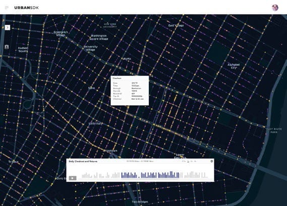
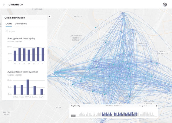
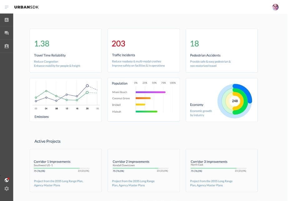
In Jacksonville, Urban SDK’s platform is being used to develop a Congestion and Transportation Data Dashboard, enabling the North Florida TPO to manage congestion and transportation planning more effectively and to report on its commitment to improving the region’s services.
Urban SDK’s systems help reduce congestion by going beyond data gathered from sensors and cameras and incorporating emerging mobility technology and data from connected vehicles. They improve safety by using location intelligence to analyze traffic incidents and response times, in addition to pedestrian walking patterns, in order to enable better routing and safety technology deployment. And by connecting public and third-party consumer transportation data, Urban SDK can analyze and plan equitable access to sustainable transportation.
Finally, their solutions help cities to track and ultimately meet their climate goals by predicting impacts on emissions, fuel consumption, and air quality.
“Urban SDK provides us visibility, analytics, and predictive intelligence on our local and regional roadways through sensors, traffic systems, and vendor technology deployments,” says Jeff Sheffield, Executive Director of North Florida TPO. “This allows us to configure and analyze disparate data for road safety and better transportation services.”


Urban SDK’s efforts and solutions have garnered significant and much-deserved support and attention. The company was a finalist in the California Technology Council “Smart Cities Week” Pitch Fest and helped North Florida to be named a finalist in an exclusive Smart Regions competition. Urban SDK is also part of the 2019 Startup in Residence (STIR) cohort, which pairs startups with cities across the country to solve civic challenges.
Urban SDK collaborated with other innovators to foster innovation in IoT and smart city Technologies, and the company has partnered with the City of Memphis and MATA to build a data management platform for transit planners.