We provide a one-stop digital solution for companies that need to visualize and simulate the risks of climate change and environmental hazards.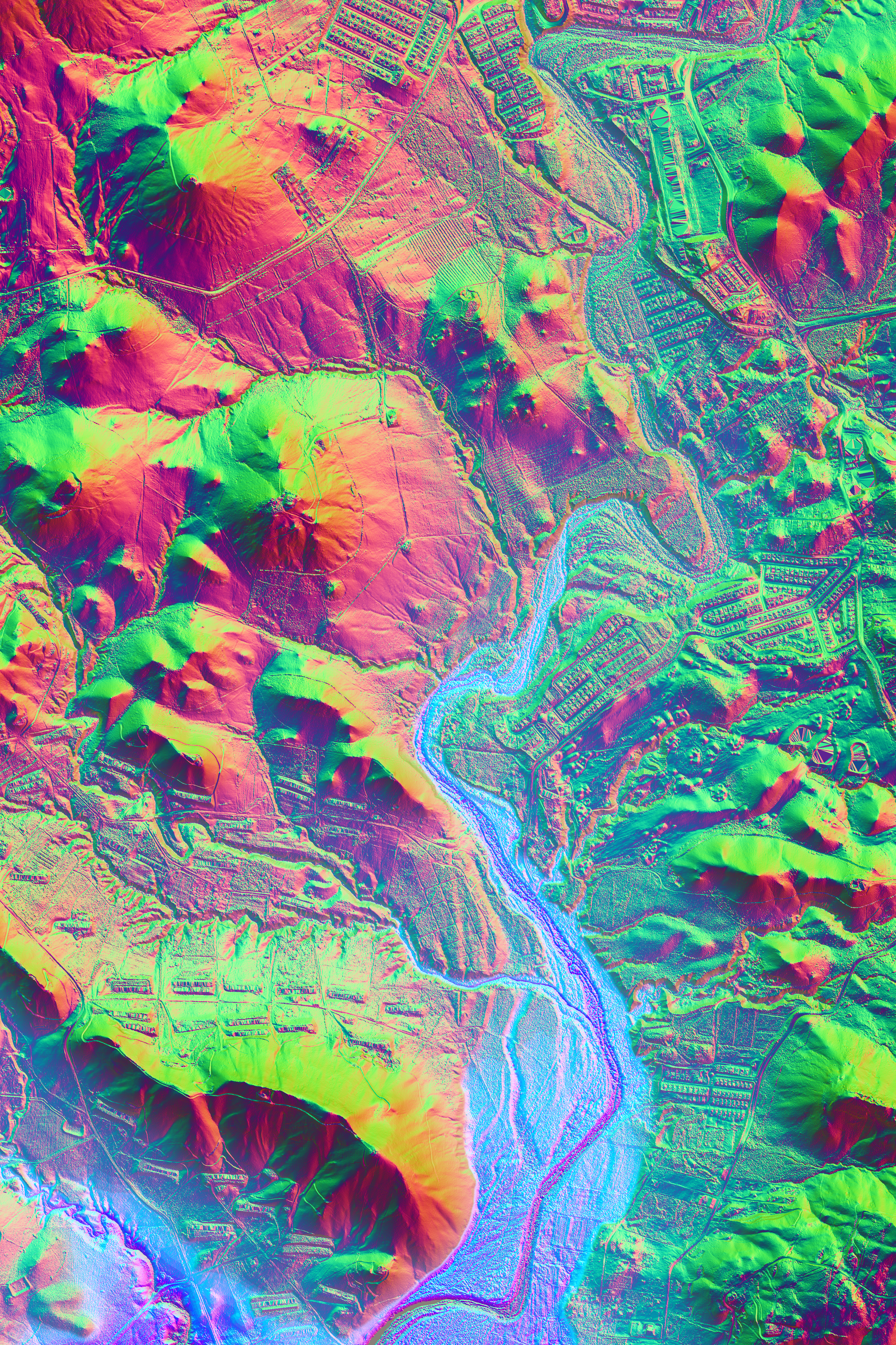
Map of Coamo River, depicting height maps, river depths and North-West-South-East orientation.
According to NOAA, climate disasters alone cost $145 billion during 2021 in the US. In proportion with the increase in severity and frequency of natural disasters, governments and the private sector are in need of increased agility in the process of protecting our cities and natural resources.
Large scale environmental studies and mitigation strategies currently depend on a mixture of software and datasets of varying quality. This results in inadequate access to data, delayed preparedness timelines, dependence on software personnel for scientific insights, and limited capacity to convey results to communities. TerraFirma joins federal datasets for soil and weather, with algorithms for studying solar exposure, hydrology, and wind patterns for every single meter of Puerto Rico since 1941, generates USDA-certified conservation solutions, and conveys them to the general public.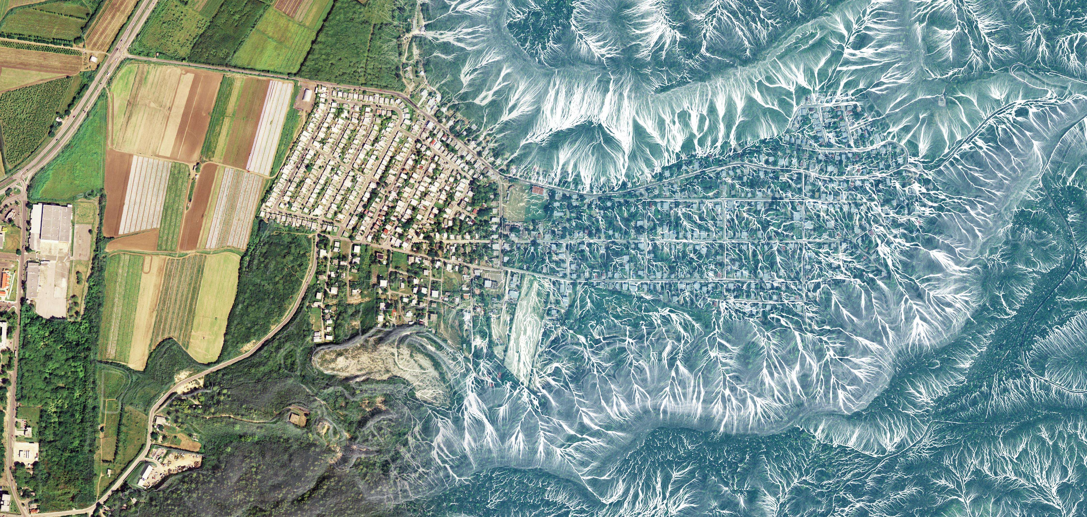
Map of Community in Guánica, depicting rainwater flow accumulation in gallons per minute
Our technology provides resource planners, construction professionals, and government officials with a set of digital tools that joins remotelysensed territorial data, algorithms, and visualizations to accelerate largescale wind, solar, and hydrologic studies in real-time. This will reduce years of research into weekly time- frames, where the end-result can be easily disseminated to the general public and applied by stakeholder communities, Government Agencies and NGOs.
We are a Puerto Rican company, founded in November 2019, dedicated to streamlining the process of preserving our natural and built environments.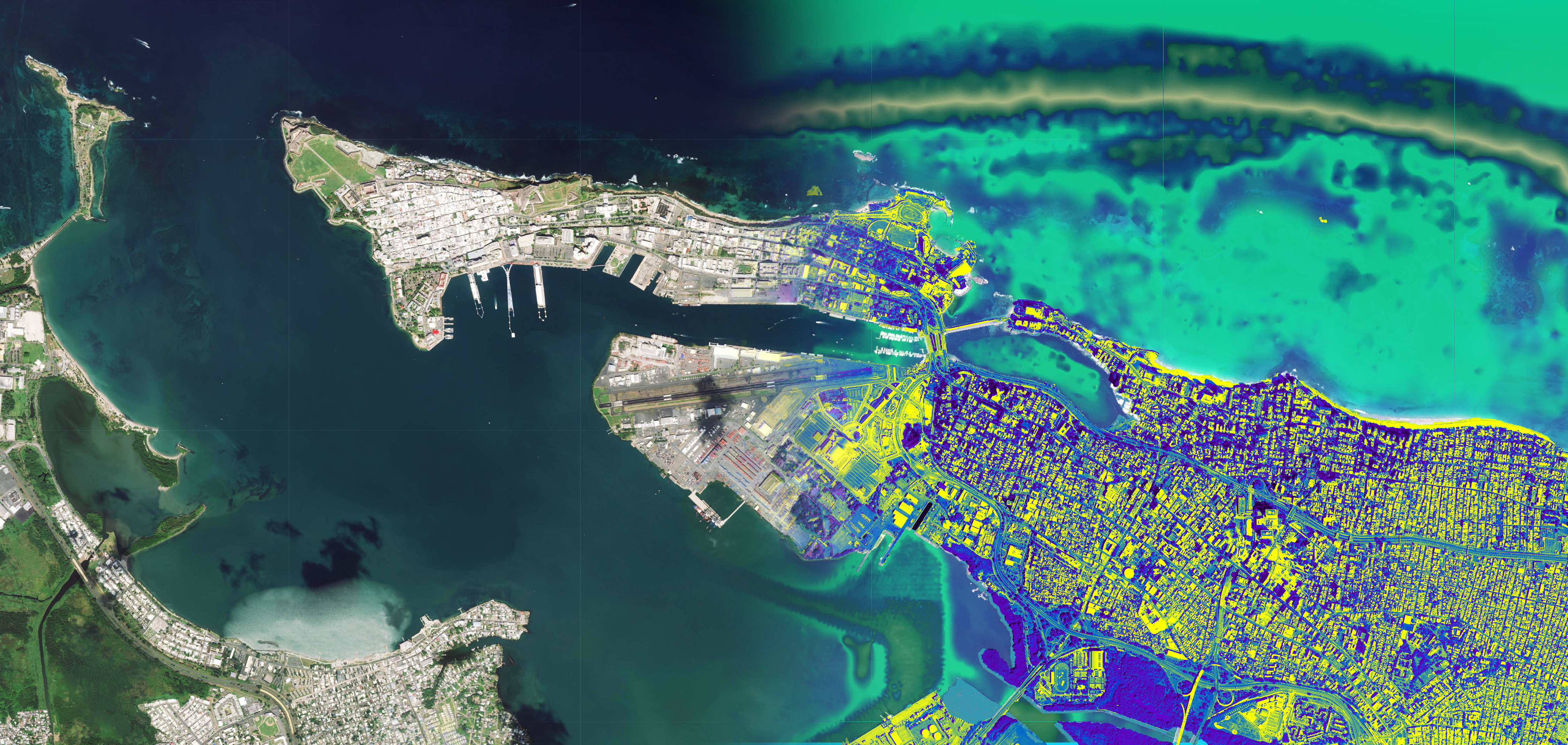
Map of San Juan Bay, depicting marine ecosystems, and Impacted/ Constructed Areas in Carolina, detected through Artificial Intelligence algorithms.
Technology:
TerraFirma is able to speed up large scale environmental studies in a single cloud-based platform by joining federal datasets with an extensive catalogue of proprietary algorithms for studying solar exposure, hydrology, and wind patterns. In its current phase, the company’s scope is focused on Puerto Rico and the U.S. Virgin Islands, although these physics models are valid for other tropical regions sharing climate similarities around the Caribbean Basin. Our technology brings together expertise from soil, agriculture, and environmental sciences, to create scientifically accurate simulations.
The current data set is based on LIDAR sampling of the totality of PR, at a resolution of 1 m2, where each meter tile has been assigned information regarding soil properties, and meteorological data since 1941.
This base-data is combined with our proprietary algorithms to:
a) Recreate rainfall patterns by using our own particle-solvers that allow for more than 3 million particles running simultaneously in reaction local pressure, slope, accumulation, particle velocities, soil properties, rain amount, and land-cover, in order to determine at-risk areas, in terms of erosion, flooding, water-contamination, habitat-risks, among other issues related to the environment.
b) Recreate wind patterns by using our own fluid-solvers that allow for more than 1.5 million vectors running simultaneously and reacting to data such as air-density, pressure, velocity, and temperature, soil and land cover properties. This allows us to assess wind-related events on urban environments, agricultural fields, or natural resources according to historical weather patterns, or user-determined meteorological properties displayed upon the terrain.
c) Visualize cumulative and time-dependent solar simulations based on exact solar positioning through time of year, at a per-second resolution, for any coordinate. This allows us to depict solar paths and percentage of times under shadow and sunlight for any area of PR. This is essential to understanding agricultural areas in need of specific sunlight exposure, eroded areas, habitats dependent on humid areas, and heat-island effects in urban environments, among others.
d) AI processing of aerial views to determine eroded/erodible areas, constructed/urban areas, vegetated and sparsely vegetated areas anywhere in PR. This allows us to distinguish areas of environmental risk for further planning or expert assessment, and to be included in the previously mentioned simulations as initial data.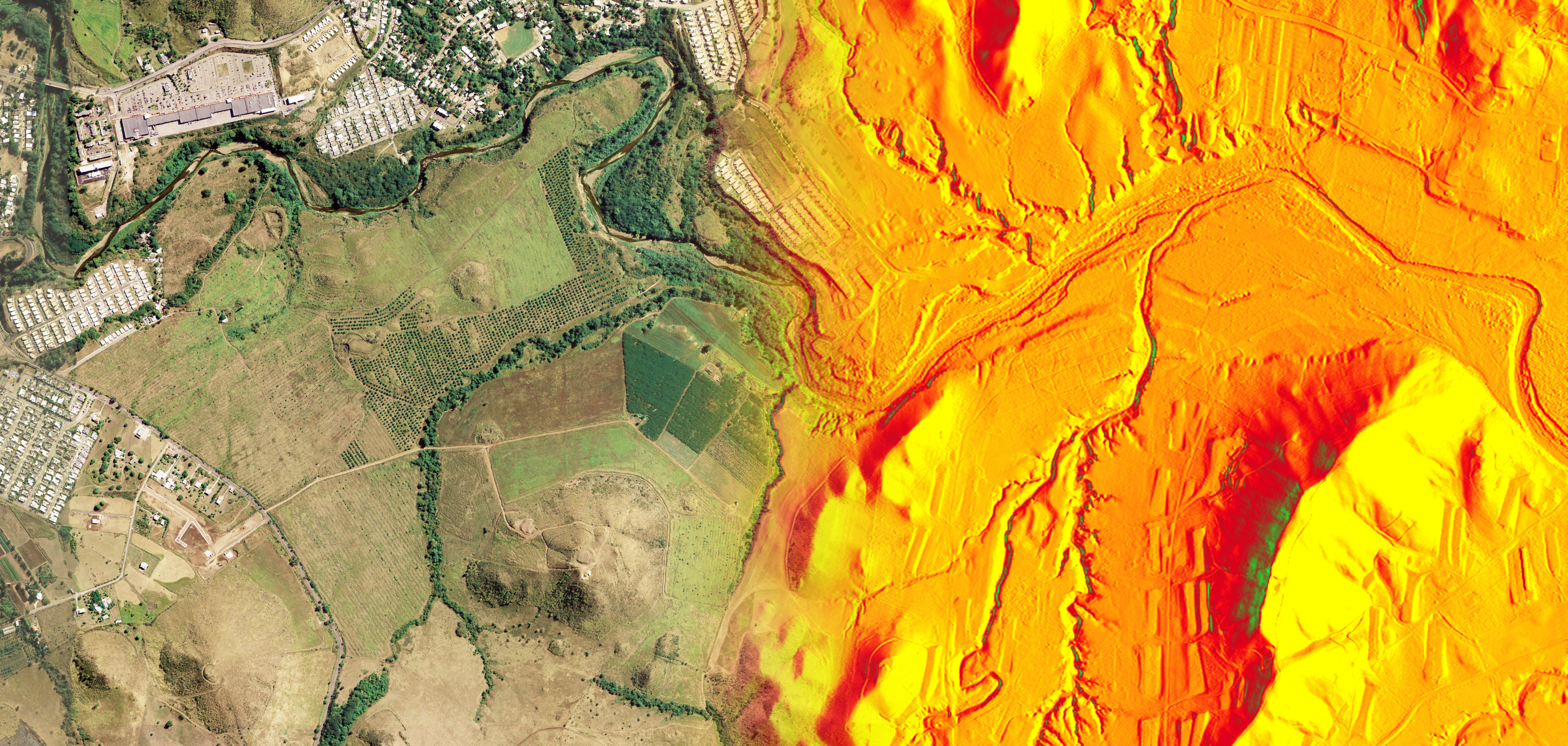
Map of Coamo, depicting One Year Solar Accumulation, per square meter. Most exposed areas to sunlight are in yellow, and prolonged shadow cover in green.
These algorithms have allowed us to develop a catalogue of services for applications such as: a) mitigating soil erosion in agricultural lands and natural resources, b) mitigating and planning for flooding in urban, constructed, natural resources, and touristic areas, c) habitat protection and scouting of species according to humidity indexes, d) planning for touristic and agro-touristic potential based on soil types and proximity to water bodies, and e) planning of agricultural lands and renewable energy projects based on solar and wind exposure.