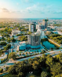
Aerometrex is a geospatial technology company focused on providing data and derived insights for a range of applications. Launched in 1980, the company is a preferred supplier of aerial imagery, 3D models and LiDAR data for both the public & private sectors. The company is headquartered in Adelaide and stands for innovation in the spatial data and technology segment, with many firsts to its name.
From an employee buyout in 2011 to being listed on the ASX in Dec 2019, Aerometrex has come a long way. In the last decade, the organisation has added some key achievements to an already long list of innovations. Among these are launching a world-leading 3D business, acquiring & expanding their LiDAR business, and introducing a subscription-based aerial imagery product, MetroMap. You can see the company’s fingerprints across many critical projects, such as driving smart city and digital twin projects, supporting sustainability & greening initiatives, simulating emergency scenarios such as floods and long-term changes such as coastal erosion, and supporting landowners practising informed agriculture and driving greater yields, to quote a few.
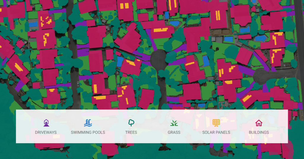
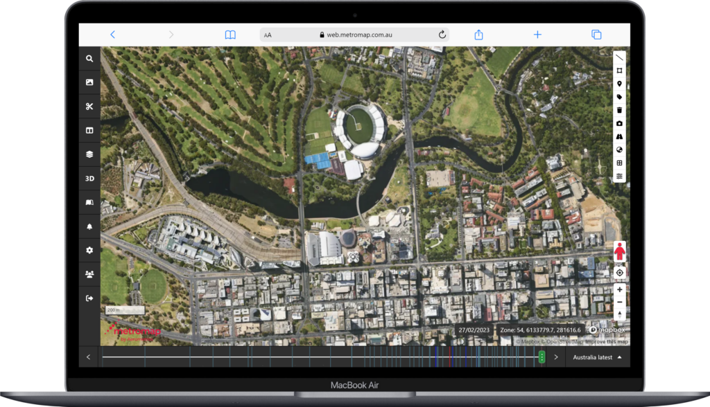
In the past, the belief was that spatial data is costly and can only be accessed by large businesses and the government. However, that has drastically changed in the last few years. One of the things that has helped achieve this is the cloud-based delivery of spatial data as a service (DaaS). Aerometrex launched its DaaS solution, MetroMap in 2015, making aerial imagery accessible even to sole proprietors. The MetroMap platform and the quality of its imagery have been referred to as “Google Maps on Steroids” by many, giving you an idea of the clarity and resolution, that one can expect. Designed to help businesses conduct remote measurements, perform accurate assessments, quote jobs, showcase work via aerial shots, and more, MetroMap is a great example of innovative technology doing good for a large cross-section of the community. As a DaaS solution, MetroMap also allows users to pull their imagery into a range of web and desktop applications. In May 2023, the company launched “MetroMap Insights” – a product that leverages the power of cutting-edge AI algorithms, cloud-computing, data science and high-resolution aerial imagery, to transform the way businesses derive valuable information from aerial maps and make better-informed decisions.

Aerometrex launched its proprietary 3D modelling solution in 2012. Known initially as Aero3Dpro, this product soon became a benchmark for high-resolution 3D data in Australia. Since then, this 3D offering has taken the Adelaide-based business to the international stage, with projects across France & Germany, before they launched a US operation in 2020. Among its list of prestigious clients are tech giants such as Google, well-known broadcasting & entertainment companies, and multinational engineering firms revolutionising the way we visualise the real world in digital form. The company has also partnered with leading 3D visualisation, software, and game engine companies to drive adoption and improve accessibility. The company has built 3D models of major cities across Australia, New Zealand, and the United States and their data is a critical component of many digital twin projects. True to the company’s ethos of driving accessibility for spatial data, it made 3D models also available via a MetroMap store, launched in 2021. The store allows users to buy 3D mesh data for even small areas in an affordable fashion, without worrying about high-cost aerial captures.
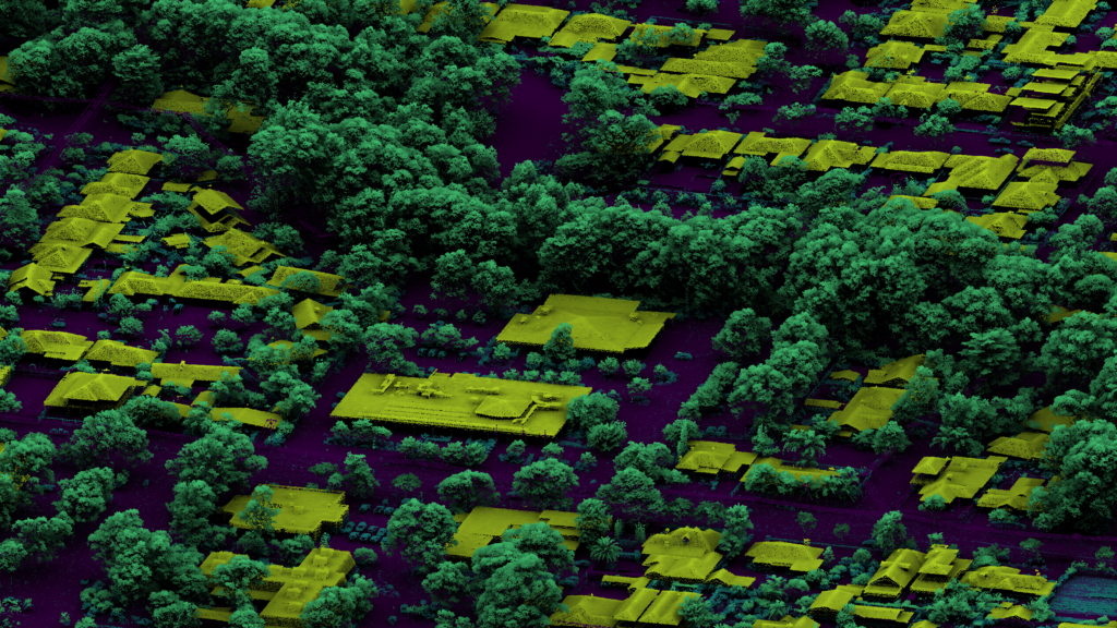
Until 2015, Aerometrex 2D and 3D products were derived from imagery and the science of photogrammetry. In September 2015, the company acquired a Queensland-based company known as Atlass and entered the LiDAR business. Since then, the company’s LiDAR operations have expanded from a singlesensor fleet to one that requires over 5 sensors and planes. The company has supplied critical LiDAR data to major federal & state agencies and does repeat projects for some large corporates. LiDAR sensors acquire details of both the ground and above-ground features such as vegetation and infrastructure, with accuracy unparalleled by other airborne methods. Aerometrex’s quantitative elevation datasets have a wide range of uses across the planning of local engineering works, tracking mining operations, city-wide urban planning, groundwater management and flood mitigation planning. Additionally, quantitative Airborne LiDAR-derived vegetation datasets provide critical environmental insights that are used in a wide range of strategic planning to increase climate resiliency in Australian communities, including urban greening initiatives, regional carbon credit projects and bushfire risk mitigation.
Technology continues to remain at the forefront of current innovation, and Aerometrex is the perfect crossover between tech and spatial data that is helping businesses make the most of these developments. Keep an eye out for this Adelaide-based organisation that is helping companies and governments build solutions for the future.